


Spatial Heatmaps

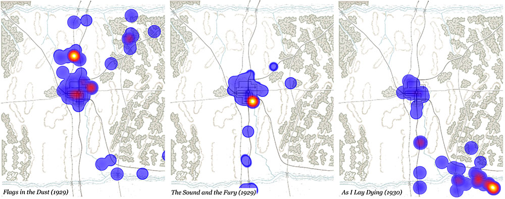
Heatmaps use colors to measure levels or locations of activity. The heatmaps here are our attempt to represent the way Faulkner's imagination inhabits different parts of Yoknapatawpha in different texts and at different points in his career, according to the color scheme below. The "cooler" colors on the left (violet, blue) indicate the least activity; the "hotter" ones to the right (yellow, orange) indicate the most:

You can access the maps via any of the 7 sequences below. The last 5 group together the stories and novels geographically, allowing you to see which narratives are centered in the various parts of Faulkner's world. In all the sequences the texts are arranged in chronological order of publication. (For more on this way of visualizing the fictions, use the About link above right.)
- All Texts (68 maps)
- The Novels (14)
- Jefferson (21)
- Northwest (17)
- Northeast (8)
- Southeast (12)
- Out of Yoknapatawpha (10)